| Message/Author |
|
|
 David Jud (Davidjud) posted on Thursday, July 02, 2009 - 10:19 am David Jud (Davidjud) posted on Thursday, July 02, 2009 - 10:19 am
|
|
|
What exactly do the numbers in the sediment output file mean:
- Are they the total sediment load in the timestep (in m3) / I assume yes as it is the same in the input file.
- Do the volumetric numbers include porosity (about 30%) of the sediment. / I assumed yes. So if the output was deposited it would be less.
Cheers
David |
|
|
|
|
Hi Dave,
Correct -
They are volumes - so should (I think) include porosity. |
|
|
| David Jud (Davidjud) posted on Monday, August 24, 2009 - 03:10 pm
|
|
|
Another question about sediment output.
I'm doing some sensitivity analysis at the moment. So I did simulations with two different grain size distributions: one with finer material, the other with coarser material.
As expected the sediment output of the modelling area (catchment.dat) is much higher with the finer material.
Looking at the elevation output of the two different models and comparing it with the initial elevation of the river bed, there is not much difference in the statistics of the raster files. Although looking at the calculated files there can be much more erosion seen with the finer sediment the statistics are almost the same:
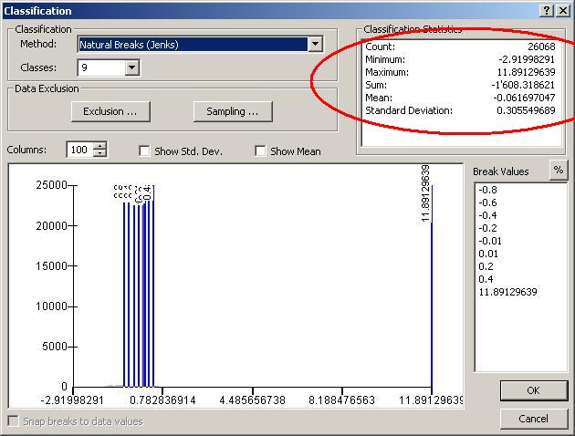
In ArcGIS: Layer Properties -> Symbology -> Classify (Classification Statistics)
Minimum (biggest erosion on one cell), Maximum (biggest aggradation on one cell) and Sum (Total amount of erosion/ aggradation in meters) stay the same for both the finer material model and the coarser material model. (I attached a screen shot of this for better understanding).
Why are they not different as the sediment output is also (much) different? |
|
|
| Back to top |